
 Member Login
- Who We Are
- Membership
- Economic Development
- Experience DeWitt
- Media Room
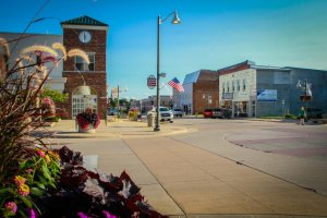
DeWitt is centrally and strategically located to connect your business to multi-modal transportation networks. Whether you are in need of major interstates and four-lane highways, barge terminals, rail service, and/or commercial air service, DeWitt is within minutes of each network and can provide you easy access to major Midwestern and global markets.
Click here for detailed transportation network maps.
Looking for a specific good or service? LOOK LOCAL FIRST and explore the over 200 local members in our DCDC Business Directory.
Hello DeWitt!! My name is Brittany Berrie and I am the Director at The Adopted Closet! My partner Branden and I moved to DeWitt a little over two and a half years ago now and have loved getting to know this awesome community! We have three crazy...

_300_200_85_s_c1.jpg)


Joining the DCDC marketing committee has allowed me a great opportunity to be a part of a group of local people with widely varying backgrounds, challenges and objectives. We have united around a set...
more